In a new collector's edition, explorer and former editor of the celebrated Himalayan Journal, curates sketch-maps and stories from some of the most perilous expeditions into the range
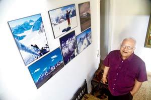
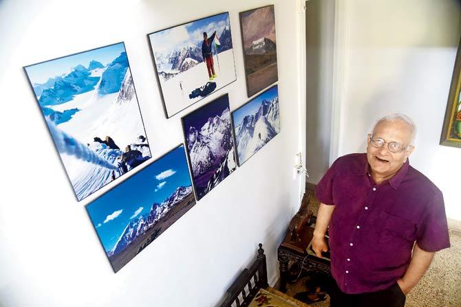
Mountaineer Harish Kapadia, ex-editor of The Himalayan Journal, has climbed more than 30 Himalayan peaks. Pic/Atul Kamble
ADVERTISEMENT
Any adventurer daring an expedition into the Himalayas would be aware of the perils of taking on its steep and treacherous terrain. It's possibly why survival stories from these lofty mountains always make for the best reading material, especially when planning explorations in this region. One such story - documented as the most daring yet - took place 26 years ago, and involved a group of Indo-British mountaineers, who were climbing several peaks in the Panch Chuli group in Kumaun, Uttar Pradesh. It was sometime towards the end of expedition, that leading British mountaineer Stephen Venables had a fall, which left him immobile at about 21,000 ft on the slopes of Panch Chuli V. A helicopter had to be arranged, and the pilot had to use great manoeuvring skills before he could attempt a successful rescue. Recalling the experience, AV Saunders, who was part of the team, would later write: "The rotor tips inches from snow, and not much more above our heads. One mistake from the pilots, and Venables and I would be salamied."
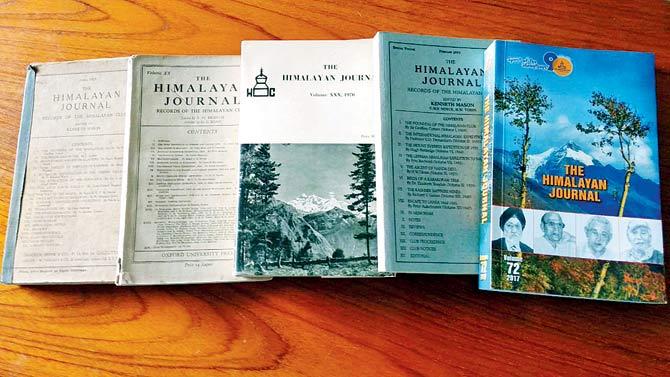
The Himalayan Journal was launched in 1929, and continues to be published annually
The incident from 1992, including a map recording that fall, by Saunders, finds mention in a new book titled Legendary Maps from The Himalayan Club (Roli Books), curated by veteran Mumbai-based explorer Harish Kapadia, 72, who coincidentally had organised the excursion. Comprising several sketch-maps of the Himalayas, the collection has been selected from nearly 70 volumes of The Himalayan Journal that was launched in 1929 by the club.
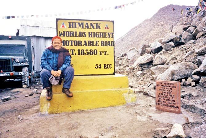
Kapadia at Khardung La in Ladakh in 1984. The veteran had taken on a risky expedition, while the Siachen War was on between India and Pakistan. “They were fighting on the west side, while we were climbing on the east,” he recalls
Drawing the Himalayan trail
Kapadia, who took over as editor of the annual journal in 1970, was associated with it for over 40 years, and continues to contribute even today. He decided to put the book together to commemorate 90 years of The Himalayan Club, which celebrated its anniversary last month, and is one of the three iconic clubs in the world, alongside The Alpine Club and The American Alpine Club.
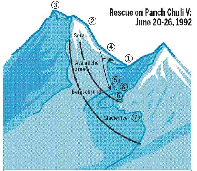
A map depicting British mountaineer Stephen Venables’ fall and rescue in Panch Chuli in 1992. Illustration/text based on original sketch-map from legendary maps of the Himalayan club, Roli books
1) Four climbers left camp at 3.30 am. [Chris] Bonington stays alone (June 20)
2) Climbers follow the south ridge
3) Summit reached at 3 pm after 12 hours of climbing
4) [Stephen] Venables falls at 2.30 am and has to be lowered to safety. [Stephen] Sustad joins Bonington to move camp (June 21)
5) Bonington falls 150m without serious injury
6) New camp set up. Sustad-Bonington descend for help (June 22)
7) Sustad-Harsinh carry rations up, which were picked up by [Dick] Renshaw-[Victor] Saunders, narrowly missing an avalanche (June 24)
8) Helicopter picks up Venables at noon (June 26)
"The book was on my mind for at least two years now," says Kapadia, who was bitten by the mountaineering bug as a teenager, when he first trekked through the Western Ghats in the early 1950s. "As editor of the journal, I had seen several sketch-maps. These maps were usually used to illustrate the stories [essays written by mountaineers on their explorations] and represented some of the most historic Himalayan expeditions." Before sketch-maps, people relied on mind maps - local villagers or early explorers looked at a ridge of a mountain and imagined what could be a route up - and descriptive maps, which were handed down orally.
The tradition of printing sketch-maps in the journal began with its first honorary editor Kenneth Mason, who was also a surveyor and understood the importance of sketch maps, Kapadia writes in the book. The map would usually be printed on the fifth page of the journal, with more inside. Since Mason went on to produce the first 12 volumes, the sketch-maps became an intrinsic part of the publication.
One reason why sketch-maps maps came to hold extra significance is due to the lack of access to the paper maps prepared by The Survey of India, known to have some of the most accurate and detailed drawings of the Himalayan range. While Kapadia, who is a recipient of the Royal Patron's Medal by the Royal Geographic Society - the first Indian to receive this adventure award after 125 years - had access to these maps, he did not have the authority to publish it due to security issues. "Hence, for any Himalayan explorer or traveller, the range is best understood through these sketch-maps," he says.
The journal in itself has outlived many experiences, under the mentorship of several mountaineers, even as the club moved offices from New Delhi to Kolkata, and later to Mumbai. Printed for several years by the Oxford University Press, it was first sold at Rs 5 - exorbitant for its time. When Kapadia took reigns, each copy would be sold for R25. The latest edition, of which 1,000 copies were published, comes at a tag of R1,200 and has contributions from some of the finest mountaineers in the world.
The mountain man
At his home in Peddar Road, Kapadia's explorations are imprinted in framed photos on every possible wall. His treks, which began in the Sahyadris, became loftier after his intense affair with the Himalayas. Despite suffering innumerable injuries, including a dislocation of his hip joint in 1974 near Devtoli opposite Nanda Devi after he fell down 100 ft into a crevice and was on crutches for the next two years, Kapadia remains resolute about pursuing the mountains. "I cannot explain this obsession. It's a mix of everything, from curiosity, adventure, the exhilaration of mountaineering, and love for nature and history. But, I can never put a finger on it," says Kapadia, adding that he never re-visits a sight once explored.
After a hip replacement surgery last May, Kapadia, who otherwise treks at least thrice a year, had been on an extended break. The veteran, who has climbed more than 30 Himalayan peaks and crossed more than 150 passes in the range, nursed his way to recovery over the last few months, and recently went on an intense two-week exploration to Pangarchulla in Joshimath, Garhwal. Next on his itinerary is Kinnaur in Himachal Pradesh. "My explorations of the Himalayas will never end. It may sound clichéd, but one lifetime is just not enough."
Catch up on all the latest Mumbai news, crime news, current affairs, and also a complete guide on Mumbai from food to things to do and events across the city here. Also download the new mid-day Android and iOS apps to get latest updates
 Subscribe today by clicking the link and stay updated with the latest news!" Click here!


